Trail and hill running routes: Edinburgh’s Pentland Hills
A selection of routes in the hills near Edinburgh that I’ve enjoyed for trail or hill running. They’re perfectly good ideas for walking trips too.

A panorama of Turnhouse Hill, Carnethy, Scald Law, South Black Hill, East and West Kip from Castlelaw Hill. (View larger). See more Pentlands photos at the foot of this page.
The Pentland Hills in Scotland are a collection of small hills above Edinburgh in the north and Penicuik in the south. Generally around 500m in altitude (the highest peak is Scald Law at 579m high), they’re not overly big but there’s commonly c.100m ascent and descent between their summits, providing ideal opportunities if you’re wanting to keep hill fit or if you’re training for Scotland’s bigger hills.
Despite being born in Edinburgh, having stayed in the city all my life and generally always been keen on outdoor activity, I’d spent only a tiny amount of time in the Pentlands prior to the Coronavirus pandemic in 2020/21. My preference was to sit indoors on a Wattbike for local exercise and venture further afield to the Scottish Highlands for my hiking, mountain biking and trail running activities. During the Coronavirus-induced lockdowns, and continuing thereafter, that changed and I’ve visited Pentland Hills Regional Park often, on occasion 2–3 times a week, usually later in the evening or after dark, when it’s nice and quiet and very peaceful. (My past lack of interest doesn’t apply to the rest of Edinburgh and the peaks get fairly busy at popular times).
Listed below is a variety of trail and hill running (aka walking / jogging) routes I like to repeat in the Pentlands. For detailed route planning plus navigation, I’d recommend Pentlands Superwalker XT25 or Pentlands Ultramap XT40 maps from Harvey Maps. If you use Strava, the summitbag.com plugin by Phil Bellamy tracks the hills you’ve climbed and totals up your ascent over time.
Entry points to the Pentland Hills
Click the below to expand and view route choices.
-
Getting there - Follow the A702 road south of Edinburgh to Flotterstone Inn. Turn right and drive past the inn to the car park. (Google Maps). The 101/ 102 Edinburgh to Dumfries bus from Houston Coaches stops opposite the inn.
Walking / running routes -
Flotterstone to Turnhouse, Carnethy, Scald Law, South Black Hill, East and West Kip before descending to the drove road past West Kip and then return — c.15km and 1200m ascent (View on Strava)
Flotterstone to the bealach before Scald Law, traversing down to Green Cleugh via the tree plantation, then up and along the side of Black Hill and over Bell’s Hill before descending Maiden’s Cleugh to reach Glencorse reservoir — c.14km and 750m ascent
Alternative - As above over Bell’s Hill but at the top of Maiden’s Cleugh head NW instead towards Harlaw on a good track. Go through a gate and then head immediately NNW to reach the road just E of Wester Kinleith (there’s a path through the woods alongside the track). Head NE on the road towards Middle Kinleith and look for the sign for Poet’s Glen. Descend that to Blinkbonny and onwards to A70 Lanark Road to finish — 15.5km and 660m ascent (View on Strava)
Flotterstone to Carnethy then continue onto the bealach before Scald Law and descend via the tree plantation to Green Cleugh. Head up the steep slopes of Black Hill (after the Pinnacle and opposite the waterfall) then descend NE from Black Hill summit to reach the bealach before Bell’s Hill. Follow the track SE to Glencorse reservoir and then take either the road back to the start or, not far past Glen Cottage, cross through a wall onto a track that goes to the filter beds and return via the start of the Scald Law route — 13km and 730m ascent
Flotterstone first to Castlelaw and then over to Allermuir. Head W to Capelaw and climb Harbour Hill and Bell’s Hill before climbing the long SW flank of Black Hill. Descend the long track from Black Hill summit to the road by Logan Burn and return to Flotterstone — 16.5km and 900m ascent (View on Strava)
-
Getting there - Follow Colinton Road out of Edinburgh city centre. Just before Colinton village, head left, following the signs for Pentland Hills Regional Park, then go uphill past Bonaly Shop to the car park at the end of the road. (Google Maps). Public transport-wise, the number 10 bus from Lothian Buses takes you closest, opposite Bonaly Shop.
Walking / running routes -
From Bonaly Tower ascend Scaletrix to Bonaly Reservoir. Climb Capelaw Hill and Castlelaw before descending to Glencorse and returning to Bonaly via Maiden’s Cleugh and Harbour Hill (or sometimes just Phantom’s Cleugh) — c.15km and 620m ascent
Repeat the above up until Maiden’s Cleugh but then descend first NW and then NNW to Kinleith buildings and then return to Bonaly via Clubbiedean and Torduff reservoirs — c.17km and 510m ascent
From Bonaly car park choose either Scalextrix or the track directly uphill through the woods to reach Bonaly reservoir. Ascend Capelaw Hill then Allermuir and Caerketton. From Caerketton’s summit, head shortly E to join a track that traverses SSE then SSW around Caerketton’s southern slopes, past Boghall Farm and the Tytler Memorial Cross, to reach Castlelaw car park. Decend from the car park to Glencorse reservoir and then ascend Maiden’s Cleugh for the return to Bonaly — c.18.5km and 790m ascent (View on Strava)
From Bonaly shops, head past the Scout Centre to the second car park. Continue uphill towards Bonaly reservoir but take the first right and then left S of Torduff and ascend through the woods to reach the foot of Scaletrix. Continue up Scaletrix and turn right through the gate and onwards to ascend Harbour Hill. From the summit, continue SE on a very runnable grassy track to reach Glencorse reservoir. Touch the gate and then turn around and take the track NW up Maiden’s Cleugh. At the next gate, either ascend Harbour Hill again for a return to Bonaly or continue NW and then W into Balerno or NW and then N to Wester Kinleith and into Currie, the latter recommended via Poet’s Glen — c.11.5km and 400m ascent (View on Strava)
As above to Harbour Hill but continue SE and then SW to the top of Maiden's Cleugh. Continue SE on often wet ground to climb Bell's Hill and then descend first NW then SW on steep, grassy ground (which can slippy lower down, when wet). Don't ascend Black Hill but take the track SE towards Glencorse reservoir. Follow the road around, past the farm and the first gate (which leads up Maiden's Cleugh). Continue along the road with the reservoir on your right and a walled field on your left until you reach a wooded area on your left. Go through the small second gate at these woods and ascend to reach a second gate. Turn right for 50 yards and then ascend steeply NE up the SW slopes of Castlelaw. Descend towards Allermuir but trend left to the reach foot of Capelaw Hill. Climb this and then continue SW and then N to return to Bonaly — c.13.5km and 630m ascent (View on Strava)
-
Getting there - Take the Lanark Road out of Edinburgh to Balerno and follow the signs to Threipmuir reservoir. (Google Maps). The 44 bus terminus for Lothian Buses is not far down the road.
Walking / running routes -
Balerno bus terminus to Threipmuir then up the Red Road to West Kip, East Kip, South Black Hill and Scald Law. Descend NW from the bealach before Carnethy to Green Cleugh (either direct to the Howe or via the tree plantation) then traverse along the side of Black Hill, continue over Bell’s Hill and Harbour Hill and descend Scaletrix to finish at Torduff reservoir / Bonaly — c.20km and 860m
Alternative (1) - Head back to Threipmuir after traversing the side of Black Hill — c.12km and 470m ascent
Alternative (2) - Descend instead from East Kip down to Green Cleugh and head back to Threipmuir via Bavelaw Castle — c.10km and 450m ascent
Alternative (3) - At Black Springs, cross over at the dam to the N side of the reservoir and return E to Threipmuir car park — c.14km and 920m ascent (View on Strava)
Follow the main route above to West Kip but head SW instead over Greenlaw and Spittal Hill to North Esk Reservoir. Follow the track to Bore Stane then descend N to Kings Hill then NE over the ‘Yellow Brick Road’ track to Western Bavelaw — c.19km and 600m ascent
Follow the ‘Yellow Brick Road’ from Wester Bavelaw farm to Bore Stane. Ascend East Cairn Hill, West Cairn Hill and Byrehope Mount. Descend to Baddinsgill Farm then climb Mount Maw, Grain Head and The Mount. Descend to North Esk reservoir and head back to Bore Stane and Threipmuir by your outward route — c.34km and 1240m ascent
Alternative - Take the ‘Yellow Brick Road’ to Bore Stane as above. Descend SSE on a fun trail to reach North Esk Reservoir. Climb from the water and continue over Spittal Hill and Green Law towards West Kip. Descend the drove road (aka ‘Red Road’ to Balerno) — c.20km and 635m ascent (View on Strava)
From Threipmuir car park, continue past Threipmur and Harlaw reservoirs to cross the dam at Black Springs. Traverse the NE slopes of Black Hill to reach Bell’s Hill. Don’t ascend Bell’s Hill but continue on the obvious track SSE towards Logan cottage (considering a not-so-visible shortcut over the lower slopes of Gask Hill) to reach the road at Logan Burn. Climb steeply up the N ridge of Carnethy before finishing at Hillend via Turnhouse, Castlelaw and Allermuir — c.17.5km and 820m ascent (View on Strava)
From Balerno bus terminus, head to Wester Bavelaw via Threipmuir and Balerno Common. Take the ‘Yellow Brick Road’ to Bore Stane and then continue SSE to North-Esk Reservoir and an ascent of Patie’s Hill. Descend to Nine Mile Burn then head to West Kip either via Cap Law or the track on its E side, returning to Balerno via the Red Road — c.25km and 705m ascent (View on Strava)
-
Getting there - Continue past Hillend on the A702 Biggar Road to Castlelaw Hill Fort Car Park (Google Maps). The 101 / 102 Houston Coaches bus to Dumfries may stop on the main road on request. The car park can also be reached on foot from Hillend.
Walking / running routes -
Head in a SE direction from the car park to the road from Flotterstone to Glen Cottage and continue SE down to the start of the route for Scald Law. Climb Turnhouse and Carnethy then continue onto the bealach before Scald Law and descend via the tree plantation to Green Cleugh. Traverse the lower slopes of Black Hill, climb Bell’s Hill over to Harbour Hill and Capelaw and descend back to Castlelaw car park — c.17.8km and 1180m ascent (View Strava)
-
Getting there - Follow the A702 Biggar Road out of Edinburgh. Just past Steading public house, turn right for Midlothian Snow Sports Centre. (Google Maps). Alternatively, a few hundred metres short of the pub follow a track W alongside the golf course to Swanston village. Lothian Buses 4 and 11 take you closest on public transport, near Fairmilehead.
Walking / running routes -
From either Hillend or Swanston, climb direct to Allermuir and continue over Capelaw Hill and Harbour Hill to Maiden’s Cleugh. Head SE on the track to Glencorse Reservoir then climb Castlelaw and Fala Knowe and return over Allermuir back to the start — c.13.5km and 790m ascent (View on Strava)
Ascend Caerketton and Allermuir, continuing over Capelaw, Harbour Hill and Bell’s Hill before heading SE on the track towards Glencorse. Continue along the road towards Loganlea reservoir and then head up the N ridge of Carnethy, returning to Hillend via Turnhouse, Castlelaw and Allermuir — c.24.5km and 1575m ascent
Alternative (1) - As above to Allermuir but, instead of heading up Capelaw, descend SW on a grassy trod to Phantom’s Cleugh to join the track down to Glencorse Reservoir — c.17km and 1230m ascent
Alternative (2) - From Glencorse, follow the road around the reservoir towards Flotterstone but, just before the first set of woods on your left, go through the gate and head towards the foot of the SW ridge of Castlelaw. Ascend here direct, steeply at first but with gradually extending views, returning to Hillend via Fala Knowe and Allermuir. — c.13.5km and 800m ascent
Climb Caerketton and Allermuir then descend Phantom's Cleugh to Glencorse and follow the road alongside Logan Burn. In between Logan Cottage and Logan House, head NW through the fence and continue W up a track towards Black Hill. From the summit, descend SW towards Balerno but then turn NNE and traverse Black Hill, heading towards Bell's Hill. Summit Bell's Hill (or traverse it instead) and then ascend Harbour Hill, descending that to reach Bonaly Reservoir. Either finish here via Bonaly or climb Capelaw and Allermuir and return to Fairmilehead via Swanston village — c.23km and 1215m ascent (View on Strava)
Alternative - As above but ascend Capelaw, Harbour Hill and Bell’s Hill before reaching the road at Logan Burn SW of Glencorse reservoir. From Black Hill summit, continue SW into Green Cleugh and head out via Balerno — 20km and 1015m ascent (View on Strava)
Castlelaw twice - From Hillend, climb Caerketton and Allermuir before continuing over to Castlelaw. Descend the steep and loose SE flank and once on the trck, continue to CastleLaw Hill Fort car park, head first S and then W and NW to climb the equally steep SW slopes of Castlelaw. After your second time at the Castlelaw summit, return to Hillend via your outward route (or descend N from Allermuir and descend instead to Swanston) — 15.5km and 880m ascent (View on Strava)
Pentland skyline — Caerketton, Allermuir, Castlelaw, Turnhouse, Carnethy, Scald Law, South Black Hill, East Kip, West Kip, Hare Hill, Black Hill, Bell’s Hill, Harbour Hill, Capelaw, Allermuir, Caerketton — c.32km and 2100m ascent (View on Strava)
Alternative - From West Kip, descend the Red Road to Threipmuir and onto Balerno — c.22.5km and 1400m ascent (View on Strava)
-
Getting there - Take the A702 from Edinburgh past Penicuik and Silverburn. (Google Maps). The 101/102 bus Houston Coaches stops on request.
Walking / running routes -
From Nine Mile Burn, head NNE, traversing Braid Law to reach the road leading to Westside Farm. Continue straight ahead, with South Black Hill and Scald Law on your left, and continue all the way past Carnethy. Climb heather to reach the track just E of Carnethy summit and return to Nine Mile Burn over the tops (heading for Cap Law from West Kip) — c.15.5km and 865m ascent (View on Strava)
-
Getting there - Take the A702 from Edinburgh past Penicuik, Silverburn and Nine Mile Burn. (Google Maps). The 101/102 bus Houston Coaches stops in the main street.
Walking / running routes -
A horseshoe route from Baddinsgill taking in West Water reservoir, King Seat, Byrehope Mount and West Cairn Hill on the west side and East Cairn Hill, Wether Law, The Mount, Grain Heads and Mount Maw on the east, with Cauldstane Slap in between — c.22km and 870m ascent (View on Strava)
As above but from East Cairn Hill trend E to Bore Stane. Cross Kitchen Moss, initially E and then NE, and then either descend before Hare Hill to Balerno — 25km and 730m ascent (View on Strava) — or continue over Hare Hill and traverse the side of Black Hill, go over Bell’s Hill and traverse the side of Harbour Hill, descending the Scaletrix route to Bonaly — c.29km and 1100m ascent
West Linton to Hillend - As above but instead of heading back to West Linton, head NE towards North Esk Reservoir from The Mount and onwards over Spittal Hill and Green Law. Continue over West Kip and the southern Pentland skyline to Turnhouse. Descend here to Flotterstone and then choose one of two ways over Castlelaw to reach Allermuir and down to Hillend — 40km and 2295m ascent (View on Strava)
West Linton to Carlops via the Roman Road and then up to North Esk Reservoir and continue over Spittal Hill and Green Law to West Kip — c.10km and 465m ascent. Various options from there back to Edinburgh.
Alternative (1) - As above but from North Esk Reservoir head NNW to Bore Stane and onwards to reach Threipmuir and Balerno.
Alternative (2) - West Linton towards Baddinsgill House via Stonypath then up onto Faw Mount and Mount Maw for a traverse of Grain Heads, The Mount and Wether Law to East Cairn Hill. Descend from there to Balerno via Bore Stane and the ‘Yellow Brick Road’ —c.18km and 685m ascent — or continue over Kitchen Moss to Hare Hill and around the side of Black Hill to descend to Bonaly via Harlaw — c.21km and 850m ascent
-
Getting there - Take the A702 towards Moffat. Park in Dolphinton (there’s no parking in Dunsyre) and follow the road to Little Sparta. (Google Maps). The 101/102 bus from Houston Coaches stops on the main road.
Walking / running routes -
Dunsyre to Hillend (a Pentland Hills marathon route) - Taking in Craigengar, West Cairn Hill, East Cairn Hill, Wether Law, The Mount, Spittal Hill, Greenlaw, West Kip, East Kip, South Black Hill, Scald Law, Carnethy, Turnhouse, Castlelaw, Allermuir and Caerketton — c.44km and 2000m ascent (View on Strava)
Dunsyre to Bonaly - As above to East Cairn Hill but descend to Bore Stane, cross Kitchen Moss to Hare Hill and traverse along the side of Black Hill. Climb Bell’s Hill, go around the side of Harbour Hill and finish in Bonaly via Scaletrix — c.37.5km and 1215m ascent (View on Strava)
The Pentland Way - Recognised as a long-distance walk from Dunsyre to Swanston, it’s also ideal for running — c.31.5km and 1150m ascent
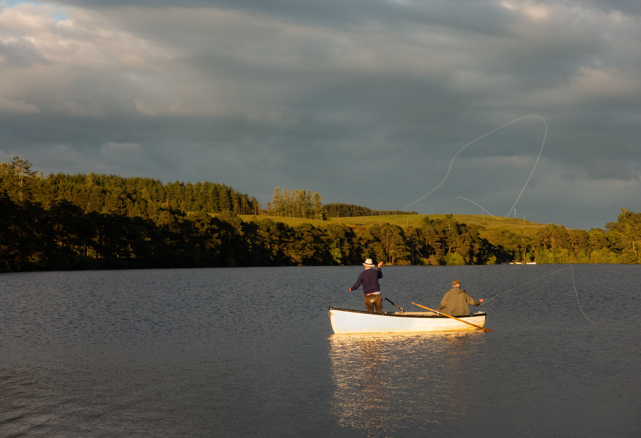
Photo gallery
I periodically post stories on my Instagram account from my visits to the Pentlands. Follow along at www.instagram.com/colinhendersonphoto (see saved Stories > Local Hills).
All photos are captured with a Sony RX100 camera which I like to use when I’m not working, or an iPhone.